Floodplain Management
The City of Orange Beach is located along an area of the Gulf of Mexico coast that has a high probability of experiencing flooding caused by hurricanes and intense rain events. As a beach community, the City's position on the shoreline places its citizens and the built environment at risk for flooding from storm surge and the subtropical climate brings heavy rainfall with the potential to cause flash flooding to low-lying areas.
We are dedicated to reducing the risk to life and property by effectively administering Floodplain Development regulations within our corporate limits. It is important for our citizens to understand not only the risks of living in a flood-prone area but also the steps they can take - education, prevention, and mitigation - before a flood happens. The City of Orange Beach recognizes that the entire community is at risk of flooding, not just those in designated flood zones.
The City maintains Elevation Certificate information on all developments within the Special Flood Hazard Area. This information is available at the Community Development office.
If you have any questions or would like additional information about your flood risk, flood insurance, mitigation, Elevation Certificates, or a flood zone determination for your property, please contact Adam Roberson, MCP, CFM, Floodplain Administrator.
Know Your Flood Risk
Understanding the specific risks your property faces helps you better safeguard your property and ensure your safety.
- Search your property on the Orange Beach Interactive Floodplain Map to find your flood zone.
- Customize your view with the mapping tools located under the address search field
- Download the Orange Beach Floodplain Map (PDF)
- Contact the Floodplain Administrator for a flood zone determination for your property.
Flood Zones in Our Area
- X (Unshaded) - Low-risk flood zone.
- X (Shaded) - Moderate-risk flood zone.
- AE - High-risk flood zone.
- AO - High-risk zone characterized by shallow flooding.
- Coastal AE - High-risk coastal area subject to tidal flooding, storm surge, and wave action in addition to regular flood hazards from rainfall or riverine flooding.
- VE - High-risk coastal area with additional hazards from storm waves over 3 feet high and fast moving water.
 Prepare - Don't Get Caught Unaware
Flooding can happen anywhere at any time. It remains the country’s number one disaster and can potentially affect everyone and every property. While you can’t prevent a natural disaster from happening, there are ways to secure your property to minimize damage to keep you and your home safe.
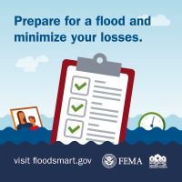
Learn more about what to do before a flood at FloodSmart.gov.
Insure Your Property Against Flood Hazard
The best way to protect your home and belongings from flood damage is to purchase flood insurance – don’t let your hard work be washed away. Speak with an insurance professional to understand your flood insurance needs.
Flood insurance is not included in a standard business or homeowner policy.
- Contents and building coverage are purchased separately, and there are always separate deductibles. Unless you have contents coverage, your flood-damaged belongings are not covered.
- Renters can purchase contents coverage even if the owner does not insure the structure.
- There is a 30-day waiting period from date of purchase until your flood insurance policy goes into effect.
In communities that participate in the NFIP, homeowners and businesses with federally backed mortgages must buy flood insurance for buildings in high-risk flood zones. Flood insurance is also recommended for areas with moderate to low flood risk.